
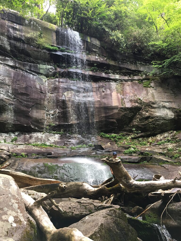
Rainbow Falls is the tallest single-drop waterfall in Great Smoky Mountains National Park, and the trail leading to it — just outside Gatlinburg, Tennessee — is one of the most popular hikes in the Smokies. That popularity comes with a catch: the trailhead parking lot is small, it fills fast, and if you show up without a plan you can lose half your morning just looking for a legal place to park.
This guide covers exactly what to expect before you go: where the trailhead actually is, how long the hike really takes, what a parking tag is and where to get one, whether you need a permit, and how to time your visit so you’re hiking instead of circling Cherokee Orchard Road looking for a spot.
Quick Answer
Rainbow Falls Trail is a 5.4–5.6 mile round trip (about 2.7 miles one way) in Great Smoky Mountains National Park, starting from the Rainbow Falls Trailhead on Cherokee Orchard Road roughly 3.4–3.5 miles from downtown Gatlinburg, Tennessee. Expect about 1,500 feet of elevation gain and 3 to 5 hours round trip for most hikers.
No hiking permit is required for a day hike, but every vehicle parked in the park for more than 15 minutes needs a parking tag ($5/day, $15/week, or $40/year), and the small trailhead lot — plus its overflow area — routinely fills by 8–9 a.m. on weekends and in peak season.
Where Is Rainbow Falls? (Tennessee, Gatlinburg, and the Smokies)
Rainbow Falls sits inside Great Smoky Mountains National Park in East Tennessee, a short drive from downtown Gatlinburg. The trailhead is on Cherokee Orchard Road, reached by driving south out of Gatlinburg through the historic Cherokee Orchard area — the same road that becomes the one-way Roaring Fork Motor Nature Trail loop. It’s roughly 3.4 to 3.5 miles from the edge of downtown Gatlinburg to the trailhead, which makes it an easy add-on to a Gatlinburg trip rather than a separate destination you need to plan a whole day around.
If you’d rather not drive and hunt for parking, Gatlinburg’s trolley system runs a seasonal route through the Cherokee Orchard Road area; check the current route map and real-time tracker on the city’s trolley page before you go, since exact routes and stops can shift season to season.
Distance, Difficulty, and the Trailhead
From the trailhead, it’s about 2.7 miles of steady, often rocky climbing to reach the base of Rainbow Falls, where water drops nearly 80 feet — the tallest single-drop waterfall in the park. Round trip to the falls and back is roughly 5.4 to 5.6 miles, rated moderate to strenuous because of the sustained elevation gain and uneven, rocky footing, especially near the falls where spray keeps the rocks slick.
Rainbow Falls Trail doesn’t stop at the waterfall — it continues on to Mount LeConte and LeConte Lodge, about 6.7 miles one way from the trailhead to the summit area. Most day hikers turn around at the falls, but it’s worth knowing the trail keeps climbing if you’re eyeing a longer trip to LeConte.
Rainbow Falls Parking: Lots, Tags, and Fee-Free Days
There’s a small parking area right at the Rainbow Falls Trailhead plus a slightly larger overflow lot about a tenth of a mile farther along Cherokee Orchard Road. Both are small relative to how popular this trail is, and on weekends and holidays from late spring through fall they can fill by 8 or 9 a.m. Once both lots are full, you’ll be circling Cherokee Orchard Road for a legal spot — which usually means moving on to a backup trail instead.
Great Smoky Mountains National Park has no general entrance fee, but every vehicle parked longer than 15 minutes anywhere in the park — including the Rainbow Falls lot — needs a parking tag. Tags cost $5 for a day, $15 for a week, or $40 for the year, and this applies year-round, not just in summer.
You can buy a tag online in advance through Recreation.gov (print it and display it on your dashboard), in person at park visitor centers and some REI locations, or from one of the self-serve parking tag machines at about a dozen locations around the park, including Sugarlands Visitor Center. There isn’t a tag machine right at the Rainbow Falls lot itself, so it’s smart to buy yours beforehand.
One exception worth knowing: parking tags aren’t required on the park’s NPS fee-free days scattered through the year. Check the official Great Smoky Mountains National Park fees page for the current fee-free dates and the latest tag prices before you go, since both can change.
Permits: What You Actually Need
No backcountry or wilderness permit is required for a day hike to Rainbow Falls. A backcountry permit is only needed if you’re camping overnight in the park’s backcountry, such as at a trail shelter or backcountry campsite along the way to LeConte.
If you’re continuing on to spend the night at LeConte Lodge itself, that’s a private, advance-reservation-only lodge on the summit — you book directly through the lodge, not through the park’s backcountry permit system. The only thing every day hiker needs is the parking tag described above.
How to Plan a Rainbow Falls Day Hike
Buy your parking tag before you leave your cabin or hotel — do it online through Recreation.gov the night before, or grab one at a visitor center on your way in, so you’re not relying on finding a tag machine near the trailhead.
Pick your arrival time around the season and the day of the week: aim for sunrise to 7:30 a.m. on weekends and during June through October, or a bit later on off-season weekdays when the lots are far less likely to fill before mid-morning.
Budget 3 to 5 hours round trip for the hike itself, plus time at the falls. Pack real hiking shoes (not sandals or worn sneakers), water, a layer for the exposed overlooks, and a rain shell if the forecast is unsettled — the trail crosses several stream sections that get genuinely slick after rain.
Have a backup plan. If both the trailhead lot and overflow lot are full when you arrive, don’t park illegally along Cherokee Orchard Road — rangers do ticket and tow. Grotto Falls off Roaring Fork is a common alternate hike if Rainbow Falls parking is shut down for the day.
Tips to Avoid the Crowds
Hike on weekdays when possible, and if you’re set on a weekend, aim to be on the trail at or before sunrise. Afternoons are consistently the busiest window, especially in June through August and during fall foliage season in October.
Check the weather before you go — heavy rain can make the stream crossings and rocks near the base of the falls genuinely dangerous — and wear shoes with real tread, since the footing on the upper switchbacks is loose and rocky even in dry conditions.
Rainbow Falls Trail hike guide FAQs
Do I need a permit to hike Rainbow Falls Trail?
No hiking permit is required for a day hike. A backcountry permit is only needed if you’re camping overnight at a backcountry site or shelter along the trail. Staying at LeConte Lodge doesn’t require a backcountry permit either — it’s a private lodge booked directly with an advance reservation.
How much does parking cost at the Rainbow Falls Trailhead?
A daily parking tag is $5, a weekly tag is $15, and an annual tag is $40. The tag is required for any vehicle parked longer than 15 minutes anywhere in the park, including the Rainbow Falls lot, and applies year-round except on the park’s NPS fee-free days.
How long is the hike to Rainbow Falls?
It’s about 2.7 miles one way from the trailhead to the falls, or roughly 5.4 to 5.6 miles round trip, with about 1,500 feet of elevation gain. Most hikers take 3 to 5 hours round trip depending on pace and time spent at the falls.
What time should I arrive to get parking?
Aim to arrive by sunrise or 7:30 a.m., especially on weekends or during summer and fall foliage season. The trailhead lot and its overflow area are small and commonly fill by 8 or 9 a.m. on busy days.
Is there a way to get to Rainbow Falls without driving and parking?
Gatlinburg’s seasonal trolley system runs a route through the Cherokee Orchard Road area, which can get you close to the trailhead without needing a parking spot of your own. Check the city’s trolley map for the current route and schedule before you go.
Is this the same Rainbow Falls as the one in Montana?
No. This guide covers Rainbow Falls in Great Smoky Mountains National Park near Gatlinburg, Tennessee. There’s a separate, unrelated Rainbow Falls on the Missouri River near Great Falls, Montana, created by the Rainbow Dam — a very different hike and landscape from the Smokies waterfall covered here.
Can I keep hiking past Rainbow Falls to Mount LeConte?
Yes. Rainbow Falls Trail continues past the waterfall all the way to Mount LeConte and LeConte Lodge, about 6.7 miles one way from the trailhead. Most day hikers turn around at the falls, but it’s a well-used route for people continuing up to LeConte.
Plan Your Smokies Trip
Build your own Smoky Mountains itinerary — save the cabins, attractions, and restaurants you want to hit. Try the free ExploreTheSmokies trip builder.