
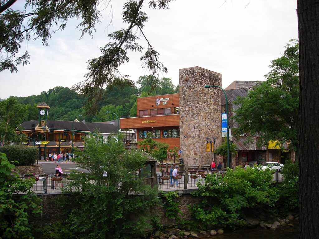
Not every cabin that claims to be “near downtown Gatlinburg” is actually walkable. Gatlinburg sits in a steep river valley, and a listing that’s technically a mile from the Parkway can mean a flat five-minute stroll or a lung-busting climb up a mountain road with no sidewalk — depending entirely on which street it’s on.
This guide ranks the specific streets and neighborhoods around downtown Gatlinburg that are genuinely walkable (or trolley-close), gives real walk-time estimates instead of vague marketing copy, and covers the free trolley routes that back up any cabin a little too far to walk from every night.
Quick Answer
The best downtown Gatlinburg cabins walking distance to the Parkway sit on River Road, in the Baskins Creek condo and cabin area, or on the lowest few blocks of Historic Nature Trail — all flat or gently sloped streets that feed directly into downtown, usually a 5-to-10-minute walk. Confirm walkability with actual walking directions and Street View rather than trusting the word “downtown” in a listing title, and treat the free Gatlinburg Trolley’s Red Route as your backup plan for anything farther out.
The Best Streets for a True Walk to Downtown, Ranked
River Road is the strongest option. It runs one block off the Parkway, has a sidewalk along its full length, and connects to downtown at multiple points near Ripley’s Aquarium of the Smokies. Cabins and chalets here are typically a 5-to-10-minute flat walk from restaurants and shops, and River Road is also one of the few streets in town with curbside parking, which is a bonus if you do decide to drive some nights.
Baskins Creek, just off the Parkway near the historic district, is next best. Condo and cabin communities here advertise themselves as roughly three blocks — about a 5-to-8-minute walk — from downtown, and because the terrain is gentler than the mountainside developments further out, that distance holds up in practice rather than turning into a switchback climb.
The lowest blocks of Historic Nature Trail (signed as Airport Road near its Parkway junction) are walkable too, but only the first few blocks. The road climbs quickly toward Cherokee Orchard and Ski Mountain Road, where the cabins have great views but are far too steep and remote to walk from.
Skip Ski Mountain Road, Chalet Village, and the upper stretches of Cherokee Orchard and Historic Nature Trail if walking matters to you. These hillside communities are popular for cabin rentals with mountain views, but the elevation gain and lack of shoulders make them a drive- or trolley-only option even when the map distance looks short.
How to Verify a Listing Is Really Walkable
Don’t rely on the phrase “walk to downtown” in the title. Drop the address into a mapping app, switch to walking directions, and check both the estimated time and the elevation profile — Gatlinburg’s terrain means a half-mile can take 20 minutes if it’s uphill.
Then pull up Street View along the route and look specifically for a sidewalk. River Road has one for its entire length, which is part of why it’s the most reliably walkable street in town, but several other connector roads near downtown have narrow shoulders and blind curves that are unpleasant or unsafe to walk after dark.
Also ask, or search the listing’s Q&A, whether the property has a hilly private driveway or a shared trailhead-style parking area. Some “walk to downtown” cabins require you to walk down — and, more importantly, back up — a steep driveway just to reach the road that leads to the Parkway.
Your Backup Plan: The Free Gatlinburg Trolley
If a cabin is more than about a 15-to-20-minute walk, check whether it sits on a Gatlinburg Trolley route before ruling it out. The system is free to ride and connects through the Mass Transit Center at Ripley’s Aquarium of the Smokies.
The Red Route is the one that matters most for cabin-goers: it runs from the Mass Transit Center out along River Road, a stretch of Ski Mountain Road, the Airport Road area, and Cherokee Orchard Road before rejoining the Parkway. The Blue Route covers East Parkway and the Community Center, and the Purple Route covers the Gatlinburg Welcome Center, Westgate Resorts, and the north end of the Parkway. The Yellow Route serves the Great Smoky Arts & Crafts Community but runs seasonally (daily April through October, then Monday through Saturday only in November and December), so don’t assume it’ll be running on a winter trip just because you saw it mentioned for a summer one.
A cabin on the Red Route can be nearly as convenient as one you can walk to, without the hill — check current maps, stops, and hours on the official Gatlinburg trolley page before you book, since routes and seasonal schedules do shift year to year.
Tips and Common Mistakes When Booking
Booking based on driving distance alone is the single biggest mistake. A cabin can be 0.8 miles from downtown by road and still be unwalkable if that road has no shoulder or a steep grade, so always check walking directions specifically, not just miles.
Skipping the parking question is another common miss. If you plan to drive into town rather than walk every time, confirm the cabin has its own parking (steep in-town lots fill fast) or use the free Park-n-Ride at the Gatlinburg Welcome Center on Banner Road, where you can park and catch the Purple Route trolley into downtown in a few minutes.
Assuming “near the Parkway” means quiet is a mistake in the other direction. Cabins right on or one block off the Parkway get traffic noise and foot-traffic crowds most nights during peak season, especially around fall foliage and the holidays. If you want walkability without the noise, River Road and the quieter ends of Baskins Creek tend to strike a better balance than a cabin directly fronting the Strip.
downtown Gatlinburg cabins walking distance FAQs
What’s considered walking distance to downtown Gatlinburg?
Most travelers consider anything up to about a 15-minute walk — roughly half a mile to a mile on flat ground — genuinely walkable. Because of Gatlinburg’s hilly terrain, always check walking time and elevation in a mapping app, not just straight-line distance.
Which Gatlinburg neighborhoods are closest to downtown on foot?
River Road, the Baskins Creek condo and cabin area, and the lowest blocks of Historic Nature Trail are the most consistently walkable. They’re flat or gently sloped, feed directly into the Parkway, and (in River Road’s case) have a sidewalk the whole way.
What is the best street for a truly walkable Gatlinburg cabin?
River Road is the top pick. It runs one block off the Parkway with a sidewalk along its entire length, connects to downtown at multiple points near Ripley’s Aquarium, and still offers curbside parking if you want to drive some nights.
Are Ski Mountain Road or Chalet Village cabins walking distance to downtown?
No. Despite short map distances, these hillside communities have steep grades and no shoulders, making them a drive- or trolley-only option. The Red Route trolley does serve Ski Mountain Road as a car-free backup.
Does the Gatlinburg trolley serve the walkable cabin areas?
Yes. The Red Route covers River Road, a stretch of Ski Mountain Road, the Historic Nature Trail/Airport Road area, and Cherokee Orchard Road. Both are free and connect through the Mass Transit Center at Ripley’s Aquarium.
Is downtown Gatlinburg itself walkable once you’re staying nearby?
Yes — the Parkway strip through downtown is flat and pedestrian-friendly, with restaurants, shops, and attractions clustered close together. The challenge is only getting to and from your cabin, which is why the street it sits on matters so much.
Plan Your Smokies Trip
Build your own Smoky Mountains itinerary — save the cabins, attractions, and restaurants you want to hit. Try the free ExploreTheSmokies trip builder.